Geolocate

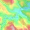
Can-untog topographic map

Click on the map to display elevation.

About this map

Name: Can-untog topographic map, elevation, terrain.

Location: Can-untog, Ormoc, Leyte, Eastern Visayas, Philippines (10.96158 124.63747 11.00158 124.67747)

Average elevation: 51 m

Minimum elevation: 0 m

Maximum elevation: 209 m

Other topographic maps

Click on a map to view its topography, its elevation and its terrain.
Binahaan River

Philippines > Leyte > Ormoc

Average elevation: 546 m

Binahaan River

Philippines > Leyte > Ormoc

Average elevation: 495 m

Ormoc City Proper

Philippines > Leyte > Ormoc

Average elevation: 18 m

Gear up for your next adventure:

🧼Biodegradable Outdoor Soap - Clean gear and yourself without harming the local ecosystem
☀️Portable Solar Chargers - High-efficiency panels to hang on your backpack while walking
🚁Camera Drones with GPS - Capture aerial views of the landscape to compare with topo maps
🎨Portable Watercolor Kits - Paint the landscapes and topographic views you discover
🌿Flora and Fauna Field Guides - Identify the plants and animals you encounter on your route

As an Amazon Associate, this site earns from qualifying purchases at no extra cost to you.