Geolocate

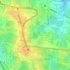
560103 topographic map

Click on the map to display elevation.

About this map

Name: 560103 topographic map, elevation, terrain.

Location: 560103, Shivanasamudra Ward, Bengaluru East City Corporation, Bengaluru, Bangalore East, Bengaluru Urban, Karnataka, India (12.88846 77.64200 12.94595 77.70779)

Average elevation: 889 m

Minimum elevation: 864 m

Maximum elevation: 920 m

Other topographic maps

Click on a map to view its topography, its elevation and its terrain.
Whitefield

India > Karnataka > Bangalore East > Bengaluru

Average elevation: 875 m

Carmelaram

India > Karnataka > Bangalore East > Bengaluru

Average elevation: 890 m

Balagere

India > Karnataka > Bangalore East > Bengaluru > Balagere

Average elevation: 874 m

Varthur Lake

India > Karnataka > Bangalore East > Bengaluru

Average elevation: 869 m

Bileshivale

India > Karnataka > Bangalore East > Bengaluru

Average elevation: 887 m

Hoodi Lake

India > Karnataka > Bangalore East > Bengaluru > Sadaramangala

Average elevation: 889 m

Kodigehalli

India > Karnataka > Bangalore East > Bengaluru

Average elevation: 881 m

Gear up for your next adventure:

💡Collapsible Camping Lanterns - Illuminate your base camp or tent for map studying at night
🧥Down Jackets - Insulated jackets for cold weather
🦟Insect Repellent - Protection against insects
☀️Portable Solar Chargers - High-efficiency panels to hang on your backpack while walking
🐍Snake Gaiters - Protection against snake bites

As an Amazon Associate, this site earns from qualifying purchases at no extra cost to you.