
Thank you for supporting this site ❤️
Make a donation
Make a donation
Gear up for your next adventure:
As an Amazon Associate, this site earns from qualifying purchases at no extra cost to you.
Sant'Erasmo topographic map
Click on the map to display elevation.
Thank you for supporting this site ❤️
Make a donation
Make a donation
Gear up for your next adventure:
As an Amazon Associate, this site earns from qualifying purchases at no extra cost to you.
About this map
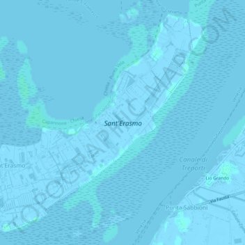
Name: Sant'Erasmo topographic map, elevation, terrain.
Location: Sant'Erasmo, Venice, Venezia, Veneto, Italy (45.44449 12.38559 45.47344 12.43201)
Average elevation: 0 m
Minimum elevation: -6 m
Maximum elevation: 3 m
Thank you for supporting this site ❤️
Make a donation
Make a donation
Gear up for your next adventure:
As an Amazon Associate, this site earns from qualifying purchases at no extra cost to you.