
Oppeln topographic map
Interactive map
Click on the map to display elevation.
About this map
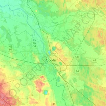
Name: Oppeln topographic map, elevation, terrain.
Location: Oppeln, Powiat Oppeln, Woiwodschaft Oppeln, Polen (50.58762 17.77959 50.76997 18.03269)
Average elevation: 161 m
Minimum elevation: 138 m
Maximum elevation: 207 m
Other topographic maps
Click on a map to view its topography, its elevation and its terrain.
Wengern
Polen > Woiwodschaft Oppeln > Powiat Oppeln
Wengern, Gemeinde Turawa, Powiat Oppeln, Woiwodschaft Oppeln, 46-023, Polen
Average elevation: 161 m
Polnisch Neudorf
Polen > Woiwodschaft Oppeln > Powiat Oppeln
Polnisch Neudorf, Gemeinde Comprachtschütz, Powiat Oppeln, Woiwodschaft Oppeln, Polen
Average elevation: 179 m