
Provincia de Anta topographic map
Interactive map
Click on the map to display elevation.
About this map
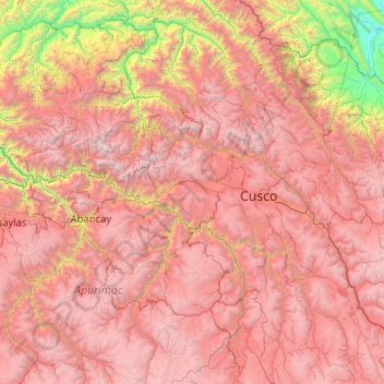
Name: Provincia de Anta topographic map, elevation, terrain.
Location: Provincia de Anta, Ancahuasi, Anta, Cuzco, Perú (-13.52000 -72.35333 -13.48000 -72.31333)
Average elevation: 3,965 m
Minimum elevation: 3,425 m
Maximum elevation: 4,308 m
Other topographic maps
Click on a map to view its topography, its elevation and its terrain.