Geolocate

Apacay topographic map

Click on the map to display elevation.

About this map

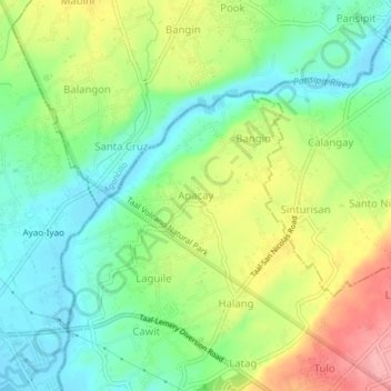
Name: Apacay topographic map, elevation, terrain.

Location: Apacay, Taal, Batangas, Calabarzon, 4207, Philippines (13.89040 120.90632 13.93040 120.94632)

Average elevation: 49 m

Minimum elevation: 3 m

Maximum elevation: 120 m

Other topographic maps

Click on a map to view its topography, its elevation and its terrain.

Bolbok

Philippines > Batangas > Taal

Average elevation: 117 m

Pansol

Philippines > Batangas > Taal

Average elevation: 69 m

Gear up for your next adventure:

📕Australia Maps - Maps covering Australian regions
🧥Insulated Down Jackets - High warmth-to-weight ratio for cold nights in the high country
🍶Collapsible Water Bottles - Save space in your pack as you consume your water supply
🎽Hiking Clothing - Breathable clothing for hiking
🔋Solar Power Banks - Solar chargers for outdoors

As an Amazon Associate, this site earns from qualifying purchases at no extra cost to you.