Geolocate

Vatersay topographic map

Click on the map to display elevation.

About this map

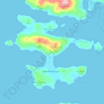
Name: Vatersay topographic map, elevation, terrain.

Location: Vatersay, Western Isles, Scotland, United Kingdom (56.90888 -7.57322 56.94936 -7.48647)

Average elevation: 18 m

Minimum elevation: -1 m

Maximum elevation: 190 m

Gear up for your next adventure:

🦯Adjustable Trekking Poles - Reduce impact on knees when descending steep topographic ridges
👕UPF 50+ Sun Shirts - Essential protection against the harsh Australian sun during field work
🧭Compass - Navigation compasses for outdoor exploration
🦘Outback Survival Gear - Essential gear for Australian outback
🔦LED Torches - LED torches for outdoor use

As an Amazon Associate, this site earns from qualifying purchases at no extra cost to you.