
Wattens topographic map
Interactive map
Click on the map to display elevation.
About this map
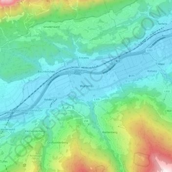
Name: Wattens topographic map, elevation, terrain.
Location: Wattens, Bezirk Innsbruck-Land, Tirol, 6112, Österreich (47.25358 11.55073 47.33358 11.63073)
Average elevation: 899 m
Minimum elevation: 540 m
Maximum elevation: 2,144 m