
Shkopet topographic map
Interactive map
Click on the map to display elevation.
About this map
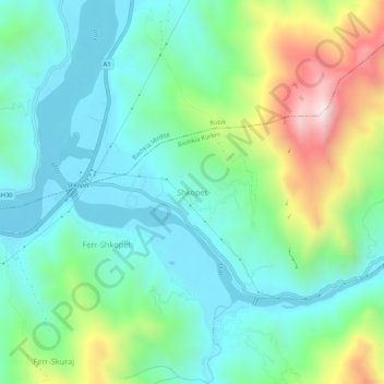
Name: Shkopet topographic map, elevation, terrain.
Location: Shkopet, Bashkia Kurbin, Qark Lezha, Nord-Albanien, Albanien (41.68357 19.76994 41.72357 19.80994)
Average elevation: 219 m
Minimum elevation: 14 m
Maximum elevation: 759 m