
Otford topographic map
Interactive map
Click on the map to display elevation.
About this map
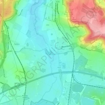
Name: Otford topographic map, elevation, terrain.
Location: Otford, Sevenoaks, Kent, England, United Kingdom (51.29608 0.16204 51.32575 0.22032)
Average elevation: 94 m
Minimum elevation: 51 m
Maximum elevation: 210 m
Other topographic maps
Click on a map to view its topography, its elevation and its terrain.
Penshurst
United Kingdom > England > Kent > Sevenoaks
Penshurst, Sevenoaks, Kent, England, United Kingdom
Average elevation: 66 m