
Chovellén topographic map
Interactive map
Click on the map to display elevation.
About this map
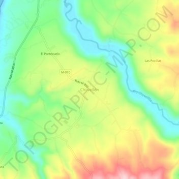
Name: Chovellén topographic map, elevation, terrain.
Location: Chovellén, Provincia de Cauquenes, Región del Maule, Chile (-35.92679 -72.68101 -35.88679 -72.64101)
Average elevation: 98 m
Minimum elevation: 0 m
Maximum elevation: 236 m