
Felberg topographic map
Interactive map
Click on the map to display elevation.
About this map
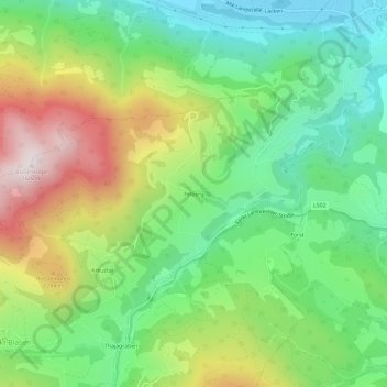
Name: Felberg topographic map, elevation, terrain.
Location: Felberg, Sankt Lambrecht, Bezirk Murau, Styrie, 8813, Autriche (47.08904 14.31175 47.12904 14.35175)
Average elevation: 1,055 m
Minimum elevation: 740 m
Maximum elevation: 1,582 m