
Lamentin topographic map
Interactive map
Click on the map to display elevation.
About this map
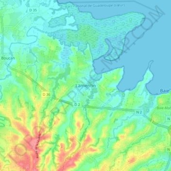
Name: Lamentin topographic map, elevation, terrain.
Location: Lamentin, Basse-Terre, Guadeloupe, 97129, France (16.23034 -61.67030 16.31034 -61.59030)
Average elevation: 20 m
Minimum elevation: 0 m
Maximum elevation: 76 m