Geolocate

Lyndhurst topographic map

Click on the map to display elevation.

About this map
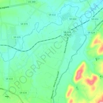
Name: Lyndhurst topographic map, elevation, terrain.

Location: Lyndhurst, Augusta County, Virginia, United States (37.98840 -78.98004 38.04949 -78.92332)

Average elevation: 446 m

Minimum elevation: 396 m

Maximum elevation: 657 m

Gear up for your next adventure:

🚁Camera Drones with GPS - Capture aerial views of the landscape to compare with topo maps
🎒Tactical Waist Packs - Quick access to your compass, phone, and snacks while walking
🎒Dry Bags - Waterproof bags for outdoor gear
📕Australia Maps - Maps covering Australian regions
🩹First Aid Kits - Emergency kits for hiking

As an Amazon Associate, this site earns from qualifying purchases at no extra cost to you.