
Valderrueda topographic map
Interactive map
Click on the map to display elevation.
About this map
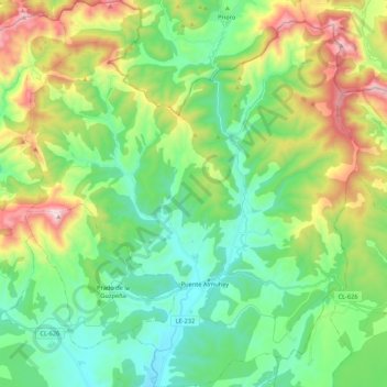
Name: Valderrueda topographic map, elevation, terrain.
Location: Valderrueda, León, Castille-et-León, 24880, Espagne (42.74400 -5.07415 42.90132 -4.88856)
Average elevation: 1,210 m
Minimum elevation: 942 m
Maximum elevation: 1,817 m