
Güepsa topographic map
Interactive map
Click on the map to display elevation.
About this map
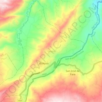
Name: Güepsa topographic map, elevation, terrain.
Location: Güepsa, Vélez, Santander, Colombia (5.99238 -73.61958 6.07924 -73.53706)
Average elevation: 1,469 m
Minimum elevation: 1,105 m
Maximum elevation: 1,891 m