Geolocate

Parma topographic map

Click on the map to display elevation.

About this map

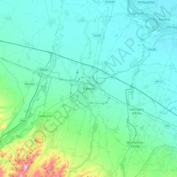
Name: Parma topographic map, elevation, terrain.

Location: Parma, Emilia-Romagna, 43121, Italy (44.64137 10.16808 44.96137 10.48808)

Average elevation: 84 m

Minimum elevation: 17 m

Maximum elevation: 531 m

Gear up for your next adventure:

☀️Portable Solar Chargers - High-efficiency panels to hang on your backpack while walking
🍳Camping Cookware - Cookware sets for outdoor meals
🧤Thermal Hiking Gloves - Keep your hands warm and functional during high-altitude winter treks
🩹First Aid Kits - Emergency kits for hiking
🛌Sleeping Mats - Insulated mats for camping comfort

As an Amazon Associate, this site earns from qualifying purchases at no extra cost to you.