
Ludmilla topographic map
Interactive map
Click on the map to display elevation.
About this map
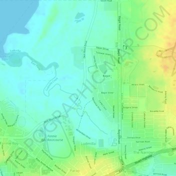
Name: Ludmilla topographic map, elevation, terrain.
Location: Ludmilla, City of Darwin, Northern Territory, Australia (-12.43064 130.83645 -12.40258 130.85701)
Average elevation: 13 m
Minimum elevation: 0 m
Maximum elevation: 32 m
City of Darwin trails, hiking, mountain biking, running and outdoor activities
Other topographic maps
Click on a map to view its topography, its elevation and its terrain.