
Home Island topographic map
Interactive map
Click on the map to display elevation.
About this map
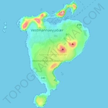
Name: Home Island topographic map, elevation, terrain.
Location: Home Island, Vestmannaeyjabær, Southern Region, 900, Iceland (63.39684 -20.31646 63.45638 -20.22557)
Average elevation: 18 m
Minimum elevation: -8 m
Maximum elevation: 243 m