
Thank you for supporting this site ❤️
Make a donation
Make a donation
Gear up for your next adventure:
As an Amazon Associate, this site earns from qualifying purchases at no extra cost to you.
Trijueque topographic map
Click on the map to display elevation.
Thank you for supporting this site ❤️
Make a donation
Make a donation
Gear up for your next adventure:
As an Amazon Associate, this site earns from qualifying purchases at no extra cost to you.
About this map
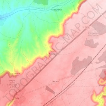
Name: Trijueque topographic map, elevation, terrain.
Location: Trijueque, Guadalajara, Castile-La Mancha, Spain (40.74533 -3.03002 40.80907 -2.92443)
Average elevation: 925 m
Minimum elevation: 737 m
Maximum elevation: 1,022 m
Thank you for supporting this site ❤️
Make a donation
Make a donation
Gear up for your next adventure:
As an Amazon Associate, this site earns from qualifying purchases at no extra cost to you.