
Glen Nevis topographic map
Interactive map
Click on the map to display elevation.
About this map
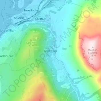
Name: Glen Nevis topographic map, elevation, terrain.
Location: Glen Nevis, Highland, Écosse, PH33 6PF, Royaume-Uni (56.78985 -5.09988 56.82985 -5.05988)
Average elevation: 178 m
Minimum elevation: -1 m
Maximum elevation: 704 m
Other topographic maps
Click on a map to view its topography, its elevation and its terrain.
Achintee
Royaume-Uni > Écosse > Highland > Glen Nevis
Achintee, Glen Nevis, Highland, Écosse, PH33 6TE, Royaume-Uni
Average elevation: 214 m