Geolocate

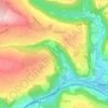
Colden topographic map

Click on the map to display elevation.

About this map

Name: Colden topographic map, elevation, terrain.

Location: Colden, Heptonstall, Blackshaw Head, Calderdale, West Yorkshire, England, HX7 7PF, United Kingdom (53.73457 -2.07612 53.77457 -2.03612)

Average elevation: 305 m

Minimum elevation: 104 m

Maximum elevation: 426 m

Other topographic maps

Click on a map to view its topography, its elevation and its terrain.
Colden Water

United Kingdom > England > Calderdale > Heptonstall

Average elevation: 226 m

Gear up for your next adventure:

🦯Adjustable Trekking Poles - Reduce impact on knees when descending steep topographic ridges
🧼Biodegradable Outdoor Soap - Clean gear and yourself without harming the local ecosystem
🪫Rechargeable Headlamps - USB rechargeable headlamps
🐍Snake Gaiters - Protection against snake bites
👖Convertible Hiking Trousers - Zip-off legs to adapt to changing temperatures throughout the day

As an Amazon Associate, this site earns from qualifying purchases at no extra cost to you.