
Caldas da Rainha topographic map
Interactive map
Click on the map to display elevation.
About this map
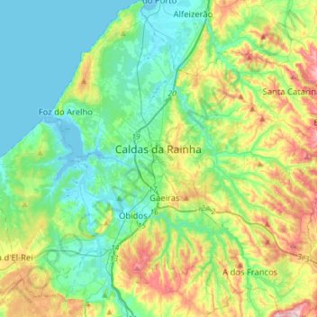
Name: Caldas da Rainha topographic map, elevation, terrain.
Location: Caldas da Rainha, Leiria, Portugal (39.29143 -9.23578 39.50978 -8.98250)
Average elevation: 74 m
Minimum elevation: -4 m
Maximum elevation: 259 m
Other topographic maps
Click on a map to view its topography, its elevation and its terrain.