
Thank you for supporting this site ❤️
Make a donation
Make a donation
Gear up for your next adventure:
As an Amazon Associate, this site earns from qualifying purchases at no extra cost to you.
Copiapó topographic map
Click on the map to display elevation.
Thank you for supporting this site ❤️
Make a donation
Make a donation
Gear up for your next adventure:
As an Amazon Associate, this site earns from qualifying purchases at no extra cost to you.
About this map
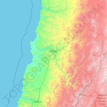
Name: Copiapó topographic map, elevation, terrain.
Location: Copiapó, Provincia de Copiapó, Atacama Region, Chile (-28.18339 -71.14235 -26.66433 -68.26321)
Average elevation: 1,659 m
Minimum elevation: 0 m
Maximum elevation: 6,289 m
Thank you for supporting this site ❤️
Make a donation
Make a donation
Gear up for your next adventure:
As an Amazon Associate, this site earns from qualifying purchases at no extra cost to you.