
مروانة تحتاني topographic map
Interactive map
Click on the map to display elevation.
About this map
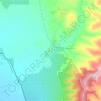
Name: مروانة تحتاني topographic map, elevation, terrain.
Location: مروانة تحتاني, ناحية جنديرس, منطقة عفرين, Aleppo, Syrië (36.40079 36.57509 36.44079 36.61509)
Average elevation: 249 m
Minimum elevation: 140 m
Maximum elevation: 520 m
Other topographic maps
Click on a map to view its topography, its elevation and its terrain.