
Thank you for supporting this site ❤️
Make a donation
Make a donation
Gear up for your next adventure:
As an Amazon Associate, this site earns from qualifying purchases at no extra cost to you.
Lindow topographic map
Click on the map to display elevation.
Thank you for supporting this site ❤️
Make a donation
Make a donation
Gear up for your next adventure:
As an Amazon Associate, this site earns from qualifying purchases at no extra cost to you.
About this map
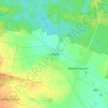
Name: Lindow topographic map, elevation, terrain.
Location: Lindow, Niedergörsdorf, Teltow-Fläming, Brandenburg, Germany (51.99206 12.90228 52.03206 12.94228)
Average elevation: 100 m
Minimum elevation: 85 m
Maximum elevation: 121 m
Thank you for supporting this site ❤️
Make a donation
Make a donation
Gear up for your next adventure:
As an Amazon Associate, this site earns from qualifying purchases at no extra cost to you.