
Biervliet topographic map
Interactive map
Click on the map to display elevation.
About this map
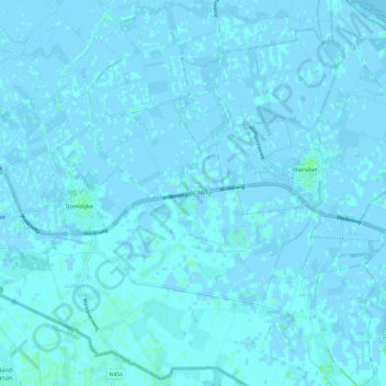
Name: Biervliet topographic map, elevation, terrain.
Location: Biervliet, Sluis, Seeland, Niederlande (51.28670 3.61813 51.36114 3.71241)
Average elevation: 0 m
Minimum elevation: -4 m
Maximum elevation: 4 m
Other topographic maps
Click on a map to view its topography, its elevation and its terrain.
Aardenburg
Niederlande > Seeland > Sluis
Aardenburg, Sluis, Seeland, Niederlande
Average elevation: 1 m
IJzendijke
Niederlande > Seeland > Sluis
IJzendijke, Sluis, Seeland, Niederlande
Average elevation: 0 m
Retranchement
Niederlande > Seeland > Sluis
Retranchement, Sluis, Seeland, Niederlande
Average elevation: 1 m