
Tintange topographic map
Interactive map
Click on the map to display elevation.
About this map
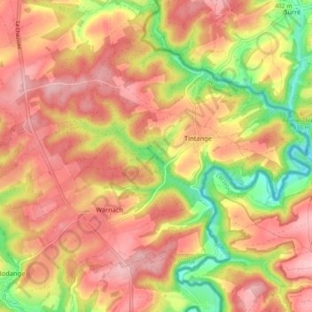
Name: Tintange topographic map, elevation, terrain.
Location: Tintange, Fauvillers, Bastenaken, Luxemburg, Wallonië, België (49.85237 5.69437 49.89822 5.78403)
Average elevation: 428 m
Minimum elevation: 328 m
Maximum elevation: 499 m