
Doxey topographic map
Interactive map
Click on the map to display elevation.
About this map
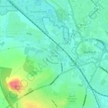
Name: Doxey topographic map, elevation, terrain.
Average elevation: 85 m
Minimum elevation: 66 m
Maximum elevation: 139 m
Other topographic maps
Click on a map to view its topography, its elevation and its terrain.
Creswell
United Kingdom > England > Stafford > Creswell
Creswell, Stafford, Staffordshire, West Midlands, England, ST18 9QU, United Kingdom
Average elevation: 90 m