Geolocate

Narberth topographic map

Click on the map to display elevation.

About this map

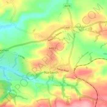
Name: Narberth topographic map, elevation, terrain.

Location: Narberth, Pembrokeshire, Wales, United Kingdom (51.78350 -4.76998 51.82807 -4.70457)

Average elevation: 75 m

Minimum elevation: 16 m

Maximum elevation: 143 m

Gear up for your next adventure:

🔋Rechargeable Batteries - Eco-friendly power for high-drain GPS units and flashlights
🍳Camping Cookware - Cookware sets for outdoor meals
🧴Sunscreen SPF - Sun protection for outdoor activities
🎒40L Day Hiking Backpacks - Comfortable packs with hydration support for long days exploring topographic peaks
🔭Compact Hiking Binoculars - Lightweight optics for scouting routes or birdwatching

As an Amazon Associate, this site earns from qualifying purchases at no extra cost to you.