
Maniwaki topographic map
Interactive map
Click on the map to display elevation.
About this map
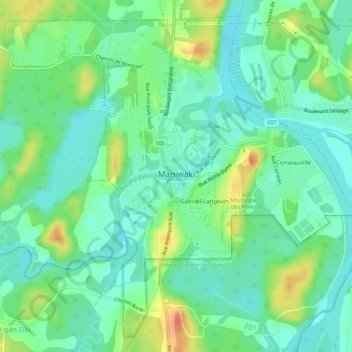
Name: Maniwaki topographic map, elevation, terrain.
Average elevation: 173 m
Minimum elevation: 157 m
Maximum elevation: 204 m
Other topographic maps
Click on a map to view its topography, its elevation and its terrain.
Lac Maton
Canada > Quebec > La Vallée-de-la-Gatineau > Lac-Pythonga
Lac Maton, Lac-Pythonga, La Vallée-de-la-Gatineau, Outaouais, Quebec, Canada
Average elevation: 397 m
Low
Canada > Quebec > La Vallée-de-la-Gatineau
Low, La Vallée-de-la-Gatineau, Outaouais, Quebec, J0X 2C0, Canada
Average elevation: 220 m
Venosta
Canada > Quebec > La Vallée-de-la-Gatineau > Low
Venosta, Low, La Vallée-de-la-Gatineau, Outaouais, Quebec, Canada
Average elevation: 171 m
Gracefield
Canada > Quebec > La Vallée-de-la-Gatineau > Gracefield
Gracefield, La Vallée-de-la-Gatineau, Outaouais, Quebec, Canada
Average elevation: 204 m
Lac du Chevreuil
Canada > Quebec > La Vallée-de-la-Gatineau > Denholm
Lac du Chevreuil, Denholm, La Vallée-de-la-Gatineau, Outaouais, Quebec, Canada
Average elevation: 394 m