
Manica Province topographic map
Interactive map
Click on the map to display elevation.
About this map
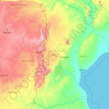
Name: Manica Province topographic map, elevation, terrain.
Location: Manica Province, Mozambique (-21.58517 32.36274 -16.38906 34.53966)
Average elevation: 519 m
Minimum elevation: 0 m
Maximum elevation: 2,480 m
Other topographic maps
Click on a map to view its topography, its elevation and its terrain.