
Eikenheuvel topographic map
Interactive map
Click on the map to display elevation.
About this map
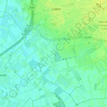
Name: Eikenheuvel topographic map, elevation, terrain.
Average elevation: 14 m
Minimum elevation: 8 m
Maximum elevation: 24 m
Other topographic maps
Click on a map to view its topography, its elevation and its terrain.
Hoogveld
Nederland > Noord-Brabant > Uden
Hoogveld, Uden, Maashorst, Noord-Brabant, Nederland, 5405 BD, Nederland
Average elevation: 22 m
Kleuter
Nederland > Noord-Brabant > Uden
Kleuter, Uden, Maashorst, Noord-Brabant, Nederland, 5406 SC, Nederland
Average elevation: 21 m
Bedaf
Nederland > Noord-Brabant > Uden
Bedaf, Uden, Maashorst, Noord-Brabant, Nederland, 5406 TM, Nederland
Average elevation: 12 m