
Cerro Las Cabras topographic map
Interactive map
Click on the map to display elevation.
About this map
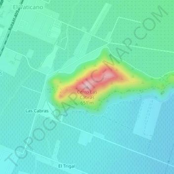
Name: Cerro Las Cabras topographic map, elevation, terrain.
Average elevation: 459 m
Minimum elevation: 415 m
Maximum elevation: 657 m
Other topographic maps
Click on a map to view its topography, its elevation and its terrain.
Las Cabras
Chile > Región del Libertador General Bernardo O'Higgins > Provincia de Cachapoal > Requínoa > Las Mercedes
Las Cabras, Las Mercedes, Requínoa, Provincia de Cachapoal, Región del Libertador General Bernardo O'Higgins, 2920244, Chile
Average elevation: 446 m