
Carvalhal topographic map
Interactive map
Click on the map to display elevation.
About this map
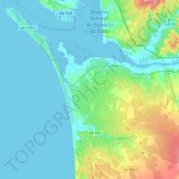
Name: Carvalhal topographic map, elevation, terrain.
Location: Carvalhal, Grândola, Setúbal, Portugal (38.23386 -8.91287 38.50534 -8.70373)
Average elevation: 24 m
Minimum elevation: -4 m
Maximum elevation: 132 m
Other topographic maps
Click on a map to view its topography, its elevation and its terrain.