
Mubende topographic map
Interactive map
Click on the map to display elevation.
Mubende
Mubende is approximately 150 kilometres (93 mi), by road, west of Kampala, the capital of Uganda and its largest city. The town is located about 145 kilometres (90 mi) east of the city of Fort Portal along the Mubende–Kyegegwa–Kyenjojo–Fort Portal Road. The geographical coordinates of the town are 0°33'27.0"N, 31°23'42.0"E (Latitude:0.5575; Longitude:31.3950). Mubende Town sits at an average elevation of 1,408 metres (4,619 ft) above mean sea level.
About this map
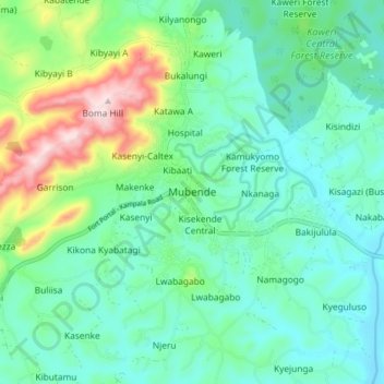
Name: Mubende topographic map, elevation, terrain.
Location: Mubende, Central Region, Uganda (0.51531 31.35509 0.59531 31.43509)
Average elevation: 1,303 m
Minimum elevation: 1,214 m
Maximum elevation: 1,573 m
Other topographic maps
Click on a map to view its topography, its elevation and its terrain.