
Nabingora topographic map
Click on the map to display elevation.
About this map
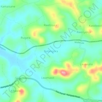
Name: Nabingora topographic map, elevation, terrain.
Location: Nabingora, Mubende, Central Region, Uganda (0.48667 31.14556 0.52667 31.18556)
Average elevation: 1,347 m
Minimum elevation: 1,304 m
Maximum elevation: 1,462 m
Other topographic maps
Click on a map to view its topography, its elevation and its terrain.