
Thank you for supporting this site ❤️
Make a donation
Make a donation
Gear up for your next adventure:
As an Amazon Associate, this site earns from qualifying purchases at no extra cost to you.
Huangzhong topographic map
Click on the map to display elevation.
Thank you for supporting this site ❤️
Make a donation
Make a donation
Gear up for your next adventure:
As an Amazon Associate, this site earns from qualifying purchases at no extra cost to you.
About this map
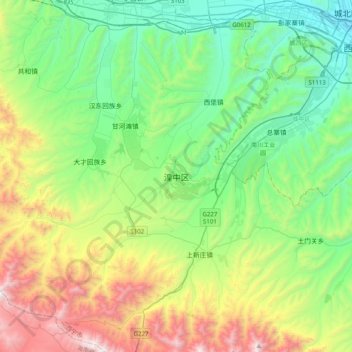
Name: Huangzhong topographic map, elevation, terrain.
Location: Huangzhong, Huangzhong District, Xining City, Qinghai, China (36.33977 101.41190 36.65977 101.73190)
Average elevation: 2,815 m
Minimum elevation: 2,230 m
Maximum elevation: 4,188 m
Thank you for supporting this site ❤️
Make a donation
Make a donation
Gear up for your next adventure:
As an Amazon Associate, this site earns from qualifying purchases at no extra cost to you.