
Pic Cassini topographic map
Interactive map
Click on the map to display elevation.
About this map
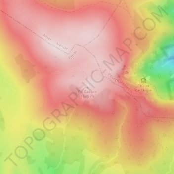
Name: Pic Cassini topographic map, elevation, terrain.
Average elevation: 1,539 m
Minimum elevation: 1,233 m
Maximum elevation: 1,680 m
Other topographic maps
Click on a map to view its topography, its elevation and its terrain.
Cascade de Runes
France > Occitanie > Pont-de-Montvert-Sud-Mont-Lozère
Cascade de Runes, Pont-de-Montvert-Sud-Mont-Lozère, Florac, Lozère, Occitanie, France métropolitaine, France
Average elevation: 971 m