
Thank you for supporting this site ❤️
Make a donation
Make a donation
Gear up for your next adventure:
As an Amazon Associate, this site earns from qualifying purchases at no extra cost to you.
Mottes topographic map
Click on the map to display elevation.
Thank you for supporting this site ❤️
Make a donation
Make a donation
Gear up for your next adventure:
As an Amazon Associate, this site earns from qualifying purchases at no extra cost to you.
About this map
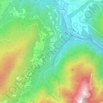
Name: Mottes topographic map, elevation, terrain.
Location: Mottes, Rivamonte Agordino, Belluno, Vénétie, 32020, Italie (46.23190 12.01091 46.27190 12.05091)
Average elevation: 994 m
Minimum elevation: 517 m
Maximum elevation: 1,880 m
Thank you for supporting this site ❤️
Make a donation
Make a donation
Gear up for your next adventure:
As an Amazon Associate, this site earns from qualifying purchases at no extra cost to you.