Geolocate

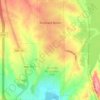
Oasis topographic map

Click on the map to display elevation.

About this map

Name: Oasis topographic map, elevation, terrain.

Location: Oasis, Sierra County, New Mexico, 87931, United States (32.90452 -107.33725 32.94452 -107.29725)

Average elevation: 1,309 m

Minimum elevation: 1,275 m

Maximum elevation: 1,392 m

Other topographic maps

Click on a map to view its topography, its elevation and its terrain.

Williamsburg

United States > New Mexico > Sierra County

Average elevation: 1,313 m

Elephant Butte

United States > New Mexico > Sierra County

Average elevation: 1,359 m

Percha Dam

United States > New Mexico > Sierra County

Average elevation: 1,272 m

Gear up for your next adventure:

🧊Insulated Cooler Bags - Keep food fresh for day trips to remote geographic sites
🦯Adjustable Trekking Poles - Reduce impact on knees when descending steep topographic ridges
🏃Compression Recovery Socks - Reduce leg fatigue after heavy days of elevation gain
🧼Biodegradable Outdoor Soap - Clean gear and yourself without harming the local ecosystem
🎨Portable Watercolor Kits - Paint the landscapes and topographic views you discover

As an Amazon Associate, this site earns from qualifying purchases at no extra cost to you.