
Eastern Point Light topographic map
Click on the map to display elevation.
About this map
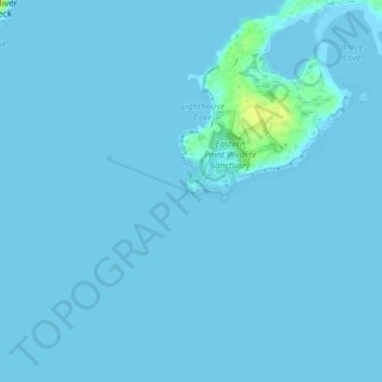
Name: Eastern Point Light topographic map, elevation, terrain.
Average elevation: 1 m
Minimum elevation: -2 m
Maximum elevation: 18 m
Other topographic maps
Click on a map to view its topography, its elevation and its terrain.
Little River Marshes
United States > Massachusetts > Essex County > Gloucester > West Gloucester
Average elevation: 27 m
Freshwater Cove Village
United States > Massachusetts > Essex County > Gloucester
Average elevation: 18 m