
Thurman Island topographic map
Interactive map
Click on the map to display elevation.
About this map
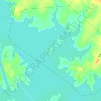
Name: Thurman Island topographic map, elevation, terrain.
Location: Thurman Island, Spotsylvania County, Virginia, United States (38.06056 -77.77004 38.06246 -77.76864)
Average elevation: 81 m
Minimum elevation: 72 m
Maximum elevation: 101 m