Geolocate

Athens Township topographic map

Click on the map to display elevation.

About this map
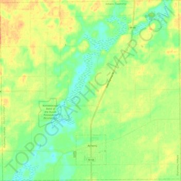
Name: Athens Township topographic map, elevation, terrain.

Location: Athens Township, Calhoun County, Michigan, 49011, United States (42.07161 -85.29540 42.15944 -85.17676)

Average elevation: 274 m

Minimum elevation: 257 m

Maximum elevation: 290 m

Other topographic maps

Click on a map to view its topography, its elevation and its terrain.
Gear up for your next adventure:

🔌Fast Charging Adapters - Quickly top up all your gear before heading back into the field
🧼Biodegradable Outdoor Soap - Clean gear and yourself without harming the local ecosystem
👄SPF Lip Balm - Prevent sun and wind-burnt lips on mountain ridges
🪫Rechargeable Headlamps - USB rechargeable headlamps
📱Shockproof Phone Cases - Extra protection for your smartphone against drops on rocky terrain

As an Amazon Associate, this site earns from qualifying purchases at no extra cost to you.