Geolocate

Batlow topographic map

Click on the map to display elevation.

About this map

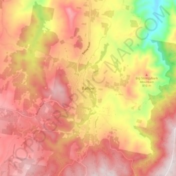
Name: Batlow topographic map, elevation, terrain.

Location: Batlow, Snowy Valleys Council, New South Wales, Australia (-35.56415 148.11108 -35.48415 148.19108)

Average elevation: 794 m

Minimum elevation: 398 m

Maximum elevation: 1,035 m

New South Wales trails, hiking, mountain biking, running and outdoor activities

Gear up for your next adventure:

🦟Heavy Duty Insect Repellent - Essential protection against flies, mozzies, and march flies
🎨Portable Watercolor Kits - Paint the landscapes and topographic views you discover
🧭Compass - Navigation compasses for outdoor exploration
🧤Hiking Gloves - Protective gloves for outdoor use
🧥Softshell Jackets - Flexible outdoor jackets

As an Amazon Associate, this site earns from qualifying purchases at no extra cost to you.