
Hå topographic map
Click on the map to display elevation.
About this map
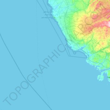
Name: Hå topographic map, elevation, terrain.
Location: Hå, Rogaland, Norway (58.33251 5.16324 58.70532 5.93470)
Average elevation: 35 m
Minimum elevation: -1 m
Maximum elevation: 533 m
Other topographic maps
Click on a map to view its topography, its elevation and its terrain.