Geolocate

Yulee topographic map

Click on the map to display elevation.

About this map

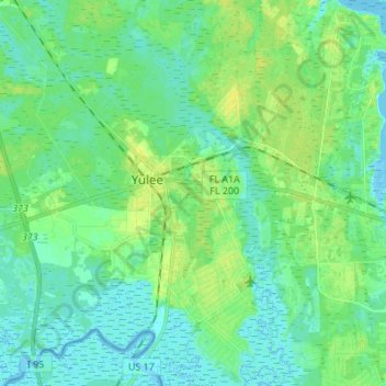
Name: Yulee topographic map, elevation, terrain.

Location: Yulee, Nassau County, Florida, United States (30.56919 -81.62261 30.68651 -81.51393)

Average elevation: 6 m

Minimum elevation: -2 m

Maximum elevation: 17 m

Gear up for your next adventure:

📣High-Decibel Survival Whistles - Signaling tool for rescue that carries much further than a human voice
🐍Snake Gaiters - Protection against snake bites
🆘Personal Locator Beacons (PLB) - Satellite emergency beacons for life-saving help in areas with no mobile coverage
📱Tablet Tripod Mounts - Steady platforms for viewing digital maps or taking long exposures
💧Personal Water Filters - Drink safely from streams and lakes identified on your map

As an Amazon Associate, this site earns from qualifying purchases at no extra cost to you.