
Petit-Canal topographic map
Interactive map
Click on the map to display elevation.
About this map
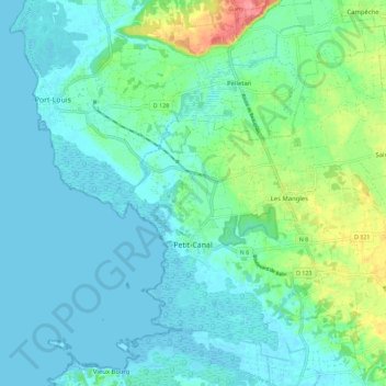
Name: Petit-Canal topographic map, elevation, terrain.
Location: Petit-Canal, Pointe-à-Pitre, Guadeloupe, 97131, France (16.33824 -61.51130 16.44599 -61.39817)
Average elevation: 16 m
Minimum elevation: -2 m
Maximum elevation: 77 m
Other topographic maps
Click on a map to view its topography, its elevation and its terrain.