
Waskish topographic map
Interactive map
Click on the map to display elevation.
About this map
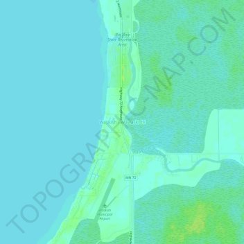
Name: Waskish topographic map, elevation, terrain.
Location: Waskish, Beltrami County, Minnesota, 56685, United States (48.14135 -94.53246 48.18135 -94.49246)
Average elevation: 359 m
Minimum elevation: 356 m
Maximum elevation: 367 m
Other topographic maps
Click on a map to view its topography, its elevation and its terrain.
Green Lake
United States > Minnesota > Beltrami County > Little Rock
Green Lake, Little Rock, Beltrami County, Minnesota, United States
Average elevation: 379 m
Bemidji
United States > Minnesota > Beltrami County
Bemidji, Beltrami County, Minnesota, 56601, United States
Average elevation: 417 m
Movil Lake Dam
United States > Minnesota > Beltrami County
Movil Lake Dam, Beltrami County, Minnesota, United States
Average elevation: 416 m
Ponemah
United States > Minnesota > Beltrami County
Ponemah, Beltrami County, Minnesota, 56666, United States
Average elevation: 362 m
Little Rock
United States > Minnesota > Beltrami County
Little Rock, Beltrami County, Minnesota, United States
Average elevation: 375 m
Long Lake
United States > Minnesota > Beltrami County
Long Lake, Beltrami County, Minnesota, United States
Average elevation: 420 m
Solway
United States > Minnesota > Beltrami County > Solway
Solway, Beltrami County, Minnesota, United States
Average elevation: 440 m
Bemidji
United States > Minnesota > Beltrami County > Bemidji
Bemidji, Beltrami County, Minnesota, 56601, United States
Average elevation: 416 m
Lake Bemidji
United States > Minnesota > Beltrami County > Bemidji
Lake Bemidji, Bemidji, Beltrami County, Minnesota, 56601, United States
Average elevation: 415 m
Wilton
United States > Minnesota > Beltrami County
Wilton, Beltrami County, Minnesota, 56687, United States
Average elevation: 425 m