
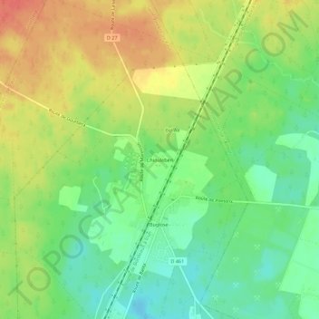
Chiouleben topographic map
Interactive map
Click on the map to display elevation.
About this map
Name: Chiouleben topographic map, elevation, terrain.
Average elevation: 43 m
Minimum elevation: 19 m
Maximum elevation: 69 m
Other topographic maps
Click on a map to view its topography, its elevation and its terrain.
Buglose
France > Nouvelle-Aquitaine > Landes > Saint-Vincent-de-Paul
Buglose, Saint-Vincent-de-Paul, Dax, Landes, Nouvelle-Aquitaine, France métropolitaine, 40990, France
Average elevation: 38 m
Le Berceau de Saint-Vincent-de-Paul
France > Nouvelle-Aquitaine > Landes > Saint-Vincent-de-Paul
Le Berceau de Saint-Vincent-de-Paul, Saint-Vincent-de-Paul, Arrondissement de Dax, Landes, Nouvelle-Aquitaine, France métropolitaine, 40990, France
Average elevation: 19 m